


The European Space Agency uses satellite technology to measure how forests store carbon over 15 years, a key factor in the fight against climate change.
Recent research shows that data from missions like SMOS allow to track changes in global forest biomass, a vital indicator of the carbon retained in vegetation. This monitoring is essential for designing environmental protection strategies against the climate crisis.
The crucial role of forests in the climate
Forests act as natural carbon sinks through photosynthesis: they capture atmospheric CO₂, store carbon in trunks, branches, roots, and leaves, and release oxygen.
This process regulates the concentration of greenhouse gases and mitigates the impact of human emissions. When forests degrade or lose biodiversity, their absorption capacity decreases, exacerbating global warming.
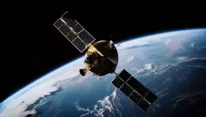

SMOS Technology: eyes on biomass
The Soil Moisture and Ocean Salinity (SMOS) mission by ESA, launched in 2009, uses an L-band microwave radiometer. Originally designed to measure soil moisture and ocean salinity, it expanded its scope to analyze forest biomass. Its microwave signal penetrates the vegetation and attenuates according to the amount of biological material, allowing the calculation of the Vegetation Optical Depth (VOD).
“The VOD indicates total mass: dry biomass plus water content. It is not a direct measurement, but it is very useful,” explained Matthias Drusch, an ESA scientist.
VOD: a key indicator for carbon
The study, published in Earth System Science Data, analyzed SMOS data between 2011 and 2025. VOD functions as a proxy for biomass and stored carbon, reflecting how radiation attenuates when passing through the vegetation.
This generates maps showing the distribution and variation of forest carbon at a global and local scale. The temporal series detects major trends such as droughts, floods, or structural alterations.
Validation with ground observations
To ensure accuracy, researchers combined satellite data with in situ measurements and other sources like ESA’s Biomass mission (launched in 2025). Paul Bodescu, a researcher at the University of Twente, highlighted:
“We combined satellite data with ground measurements. The idea is to link what we see from space with what happens inside the forests.”
This mixed approach reduces uncertainties and allows interpreting results in an environmental context.
Towards future integrated monitoring
Although Biomass, with P-band radar, offers superior structural details, SMOS maintains an advantage in extensive temporal coverage, crucial for long-term trends. The synergy between missions optimizes monitoring of vulnerable regions to degradation or extreme events.
This advancement consolidates essential tools to protect ecosystems that sustain the planet’s climate balance.
link